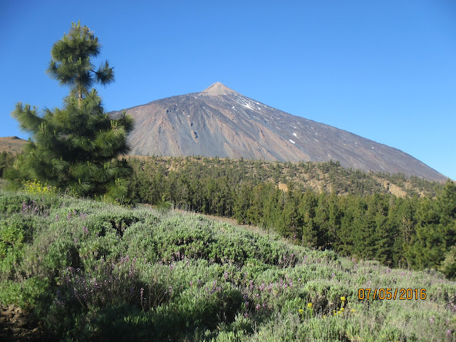
My original plan was to do it on March 5, 2016, but just two weeks before that date it started to snow very heavily and by March 5 the roads and paths were still closed and had to postpone it, though Teide looked very beautiful covered by snow.
Picture from "La Opinión de Tenerife" (http://www.laopinion.es/multimedia/fotos/sociedad/2016-02-21-41226-nieve-teide-febrero-2016.html)
My second attempt was for April 9, 2016. But the paths were still closed, so I had to postpone it again.
The third attempt was for May 7, 2016. Paths were open, and everything looked fine for that date, but just the day before I read this at the Teide National Park Facebook page:
LES RECORDAMOS QUE HOY SE REALIZARÁ LA PRIMERA (1/13) JORNADA DE CONTROL DE MUFLÓN EN EL PARQUE NACIONAL DEL TEIDE y por razones de seguridad, y mientras se desarrollan, se ha establecido la PROHIBICIÓN DE ACCESO Y PERMANENCIA EN ALGUNOS SENDEROS Y SECTORES DEL PARQUE NACIONAL.
which basically means that there will be hunters in the paths that I had to use, in order to control the muflon population.
I'm not sure what would scare me more, a hunter shooting near me or a close encounter with a muflon...
Luckily for me the hunting would be only on Friday (May 6), so I could go ahead on May 7.
Preparations
This is a long route and my plan was to do it on my own all the way to the peak, then take the cable car down to the main road where my family would pick me up to go back home. So before attempting the climb, there were some preparations to be done:
* In order to climb Mt. Teide all the way to the top, you need a permit, which you can get online at: https://www.reservasparquesnacionales.es/real/parquesnac/usu/html/detalle-actividad-oapn.aspx?ii=6ENG&cen=2&act=1
* It is obviously wise to check the weather. All was looking very good for May 7 (from http://www.meteoexploration.com/forecasts/Teide/?lang=en)
* I didn't want to go down on foot, so it is also wise to check whether the cable car is working, and I even bought a ticket online just in case. This can be done at: https://www.volcanoteide.com/en/teide_cable_car/prices_and_opening_times
* The last cable car on the way down departs the station at 16:45, so I had to make sure I would reach the station before that time. To estimate how long I would need to do the whole route I looked at Wikiloc and based my estimates on these two: http://www.wikiloc.com/wikiloc/view.do?id=5483810, http://www.wikiloc.com/wikiloc/view.do?id=3235182. Based on these routes and my statistics for previous hikes, I estimated I would need about 11 hours to do the whole climb. That meant to start walking at 05:00 to be at the peak at 16:00.
* Blisters have been a serious issue for me in previous hikes, and this was going to be a long one, so I got extra prepared and I bought: special socks (two pairs, so I could change the wet ones for dry ones en route), blister prevention cream, blister prevention tape, and band-aids. I dind't want blisters to stop me, so the plan was to stop every two-three hours and inspect the feet for possible signs of blisters and try to stop them before they could grow.
* The day before the climb I packed everything, with special attention for water (5 liters, about 50cl/hour, plus about another liter to drink just before starting).
D-Day
Kids didn't let me go to sleep until about 22:45 on Friday and, I guess due to anxiety, I was awake already by 03:00 on Saturday. My original plan was to wake up at 04:00, but it was clear I would not be able to sleep any more, so I got out of bed at 03:15. In the long run this was very lucky, because breakfast and my anti-blisters preparations took me longer than I thought. I had to force myself to have a decent breakfast at that time, then drove to Playa de El Socorro where the route starts, and I started walking at around 05:10, just a few minutes after the original plan.
The whole route took me just below 11 hours, and the Wikiloc tracking can be seen at http://es.wikiloc.com/wikiloc/view.do?id=13233788:
Powered by Wikiloc
Some pictures taken during the climb:
Time to start...
By dawn I was at the beautiful "Mirador El Asomadero"
The goal still looking pretty far!
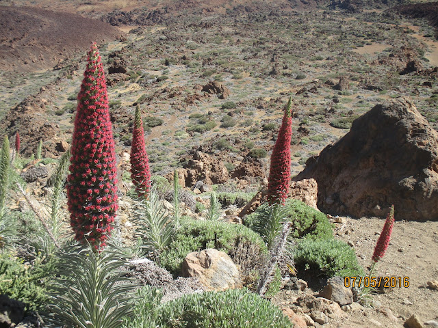
Flowering season (1)
La Fortaleza
The view at around lunch time
Down there it was pretty cloudy, but very sunny up here!
All lava rocks when getting closer to the peak.
And finally the summit!
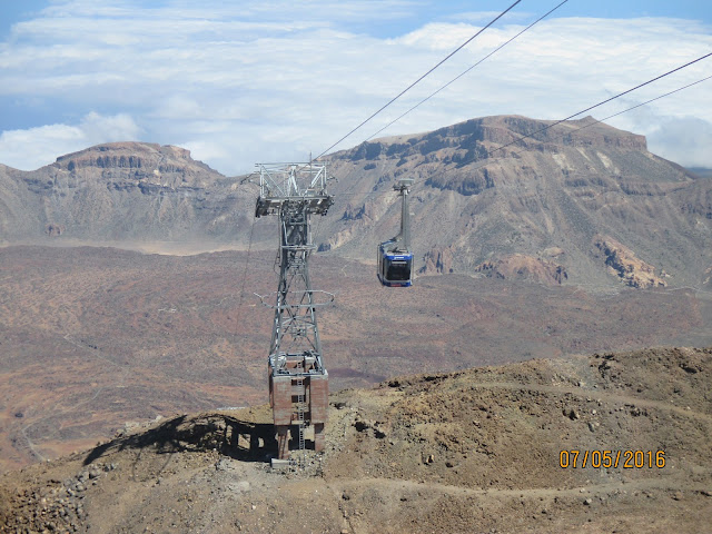
The cable car on the way down.
If you like the scenery, but don't want to do the hard work, you can see the whole route in the following video (available also at: https://youtu.be/bvaJrf7CqT4), made by uploading the GPS generated track to Google Earth, as explained in a previous post (the mobile phone crashed at least three times during the climb, so the GPS data had some gaps, and this shows in the video as some jumps, sorry!). Music track: Kostbar, from the album Lux by Afenginn (https://afenginn.bandcamp.com/album/lux)
This is obviously a hard route, and in my case I would have been happier going a bit slower, specially towards the end, when my legs were getting a bit tired, but I had to force myself to almost walk non-stop for the last few hours in order to be at the cable car station on time.
Overall it was a perfect day: the weather was very good, so I didn't need to worry about rain and it was not so cold that I had to take extra layers of clothing, just a t-shirt and a wind-proof jacket for the coldest parts. My main worries were blisters and boredom (since I did this on my own). All my anti-blisters preventions paid off, and surprisingly I had almost no blisters at all (only a couple of small ones in the little toes). Prevention for boredom was provided by my son, who lent me his MP3 player, which I filled with BBC podcasts to keep me entertained.
A friend is teasing me with going now for the 0-4-0 route (i.e. the same I did here, but then going all the way back to the starting point again). Let's see.... stay tuned!


3 comments:
I wish I was there Angel. Perhaps some day, the time is on my side, becoming younger every day. A bit jealous, but I would not like to (and could not) push that hard.
It looks very complicated to find the route in the lower part through the urban zone.
I see that Tajinaste Rojo was in full blossom, just right moment to be there.
Have to see how to add this to my site, the route you made as a video is really valuable information for everybody. I just watched it twice, sweating just by watching it. Like the music, it is very familiar to me, sounds like typical stuff from my Balkan area, but I see it is Jewish, added to my Pinterst.
Hello Angel
Great work....to be clear you did scocorro to teidi 0-4 in around 11 hours?
Someone mentioned they did it in 5 hours walking.....can this be right???
The world record for this climb is apparently ~3.5 hours (https://mountainsforeverybody.com/climbing-mount-teide-from-sea-level), so certainly it is doable in 5 hours if you are extremely fit. (For me this was my first attempt at this climb, I took several long pauses, carried about 6kg of stuff, I was 45 yo and with an office job, so even if I had pushed myself I guess I could perhaps have done it in 10 hours or so, but not much more below that).
Post a Comment